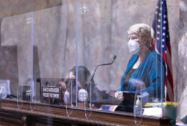
Today, Senate Democratic Caucus appointee Commissioner Brady Piñero Walkinshaw released an updated proposal for Washington’s new legislative district map. This new map follows definitive analysis released last week that the final adopted map must include a majority-Hispanic district in the Yakima Valley or face a likely successful lawsuit in federal court for non-compliance with the federal Voting Rights Act (VRA).
Commissioner Walkinshaw’s new map includes a VRA-compliant 14th Legislative District centered in the Yakima Valley in accordance with analysis provided by Dr. Matt A. Barreto, Faculty Director of the UCLA Voting Rights Project. In addition to being majority-Hispanic by Citizen Voting Age Population (CVAP), this district must have the demonstrated ability to allow Latino voters to elect their candidates of choice to the Washington State Legislature.
This map incorporates public feedback received at the October 5th Public Outreach Meeting, where more than 100 members of the public testified about their communities, as well as the hundreds of comments received in the last month since the September 21st map release. Commissioner Walkinshaw’s map also increases the number of majority-minority districts from 8 to 10 (by Voting Age Population) and reduces the number of split cities and counties, in accordance with our state’s redistricting statute. See below for a more detailed list of changes.
Commissioner Walkinshaw released the following statement:
“Last week’s analysis revealing the impacts of the Voting Rights Act on our state legislative map was eye-opening – and I am proud to release a new map today that follows our state’s redistricting criteria, keeps communities together, responds to public feedback, and undoubtedly complies with federal law. This new map not only respects the will of the voters in the Yakima Valley but also will avoid a costly legal challenge.
“Now that we have this information, we as commissioners should not consider legislative district maps that don’t comply with the VRA. It is irresponsible to the historically underrepresented communities in the Yakima Valley to entertain any proposals that undermine their rights under federal law, and irresponsible to the people of Washington state to do anything that might leave the state so blatantly vulnerable to litigation. I look forward to seeing new proposals from all commissioners so that negotiations can continue, and progress can be made.”
Both Democratic commissioners minimized city splits and population deviation in their 9/21 proposals (see attached analysis for details). Commissioner Walkinshaw’s map released today even further reduces city splits, population deviation, and county splits. It also increases the number of single county LDs and majority-minority LDs (by VAP).
Below are highlights of the new proposal:
- Has a VRA-compliant majority-Hispanic 14th legislative district in the Yakima Valley that includes the entire Yakama Nation reservation.
- Adds two new majority-minority LDs by VAP, to reach a total of 10 across the map (14, 37, 33, 30, 11, 9, 45, 29, 47, and 41).
- The two new additions are the 45th (East King County) and the 9th (Eastern WA)
- The 21st and 28th are both above 40% POC in this proposal. While reducing city and county splits and being responsive to public comment in these areas, this map also creates opportunities for even more districts to become majority-minority in the near future.
- Unites majority-minority cities of Burien, Redmond, and Pasco (which were split in Walkinshaw’s initial proposed map).
- Adds Skyway to the 37th with Southeast Seattle, per public comment.
- Keeps the Nooksack and Lummi tribes together in same LD, as they have requested. This configuration also creates a compact Bellingham/suburban Whatcom district as supported by public comment, while keeping the more rural areas in Whatcom and Skagit together in the 40th.
- Puts San Juan County back in the 40th, per public comment.
- No longer splits the Methow Valley community. Most of Okanogan county is in the 12th LD with Chelan and Douglas Counties. The split in the Colville Reservation is maintained as the current boundary, as they have requested.
- Returns Vashon Island to the 34th with West Seattle, per public comment.
- Unites Mason county and reduces multi-county LDs in the Kitsap peninsula.
- Puts Gig Harbor back in the 26th and moves the 27th back east of the Tacoma Narrows.
- Moves the 49th LD south and east, so that it includes more of Vancouver and no longer includes Salmon Creek, Mount Vista, or Barberton. The eastern border with the 17th is now I-205, per public comment. The 17th now also includes the entire cities of Camas and Washougal.
- Puts the West Central neighborhood of Spokane into the 3rd LD, per public comment.
- Keeps together cities in the Snoqualmie Valley, per public comment and tribal consultation with the Snoqualmie Indian Tribe.
- Unites Whitman county.
- Unifies South Thurston communities, in particular Tenino, Yelm, and Rainier.
For reference, attached is an analysis of all four commissioner-proposed maps that were released on September 21st.
All plans released by commissioners can be viewed here: https://www.redistricting.wa.gov/commissioner-proposed-maps.